Geospatial Analysis
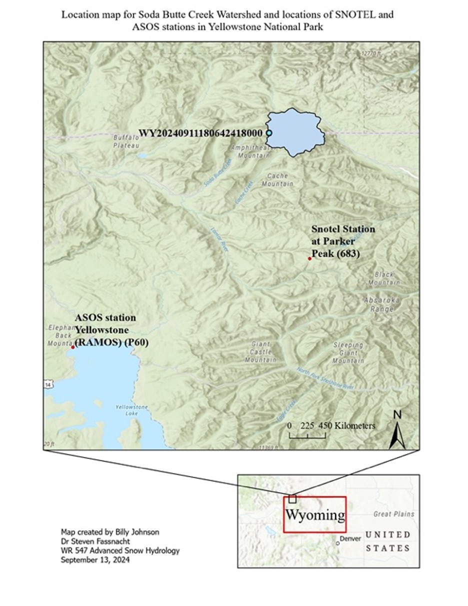
Yellowstone National Park and The Stations Used in this Project, land cover analysis
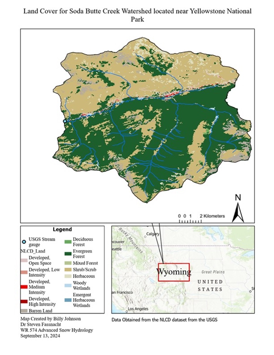
Land cover data was obtained from the NLCD a output from the United States Geological Survey
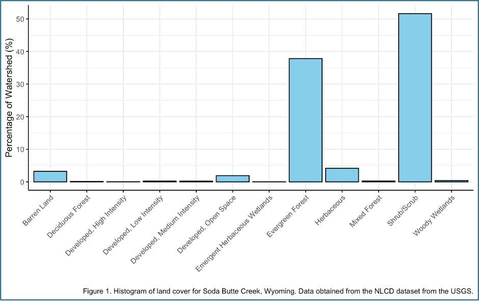
Land cover data was obtained from the NLCD a output from the United States Geological Survey